[http://creativecommons.org/licenses/by/3.0/]
This work is licensed under a CC
Attribution 3.0 Unported License [http://creativecommons.org/licenses/by/3.0/]
Poor Man's GIS
The Keyhole Markup Language (KML) is a way of how placemarks and other geographical features can be described. It is not as powerful or sophisticated as the Geographic Markup Language (GML), but it is easier to understand and use and is support as a data format by a variety of Web-oriented services and applications. Flickr, Google Maps, Google Earth all support KML and can use KML for exchanging geographic datasets.
<?xml version="1.0" encoding="UTF-8"?> <kml xmlns="http://earth.google.com/kml/2.2"> <Document> <name>UC Berkeley Campuses</name> <description><![CDATA[]]></description> <NetworkLink> <name>UC Berkeley Campuses</name> <Link> <href>http://maps.google.com/maps/ms?ie=UTF8&hl=en&vps=1&jsv=153e&oe=UTF8&msa=0&msid=116962062413210327627.00043de7109aff5329452&output=kml</href> </Link> </NetworkLink> </Document> </kml>
magic characters(in HTML/XML:
< & " '
)&
into &
XML
decodeto
US-ASCIIwhen using this service)
<Placemark> 
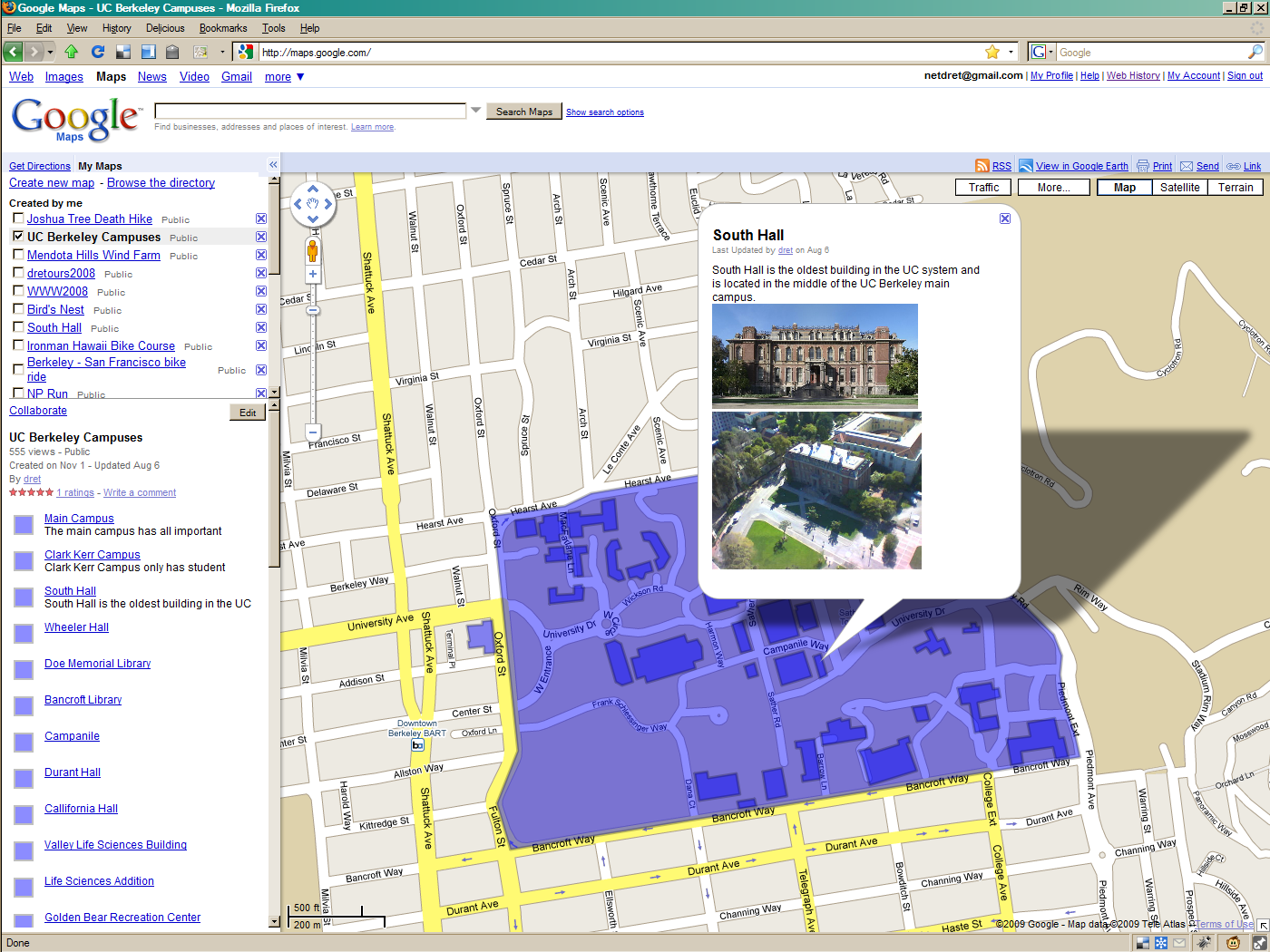
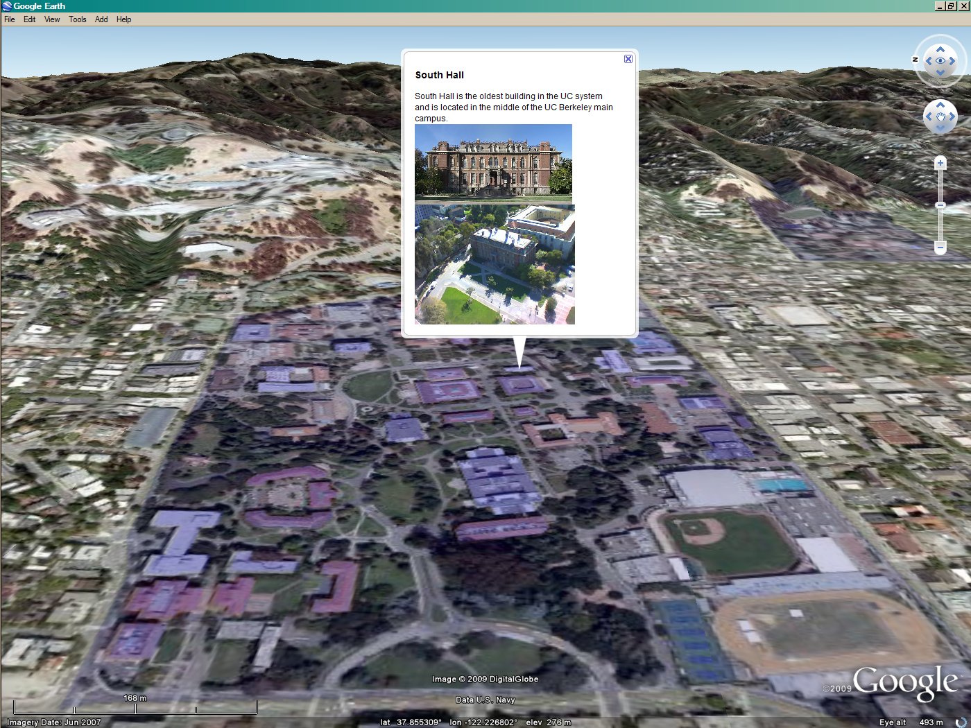
<name>South Hall</name> <description><![CDATA[South Hall is the oldest building in the UC system and is located in the middle of the UC Berkeley main campus.<br><img alt=""><img style="width:227px" src="http://upload.wikimedia.org/wikipedia/commons/thumb/7/70/South_Hall--UC_Berkeley--Panoramic.jpg/800px-South_Hall--UC_Berkeley--Panoramic.jpg"><img style="width:231px" src="http://www.cheesebikini.com/cam/art/mjg%28j66klnf.jpg"><br>]]></description> <styleUrl>#style20</styleUrl> <Polygon> <outerBoundaryIs> <LinearRing> <tessellate>1</tessellate> <coordinates> -122.258682,37.871521,0.000000 -122.258499,37.871559,0.000000 -122.258339,37.871159,0.000000 -122.258530,37.871109,0.000000 -122.258682,37.871521,0.000000 </coordinates> </LinearRing> </outerBoundaryIs> </Polygon> </Placemark>
statictour)
Poor Man's GIS
export format, not as a
native format